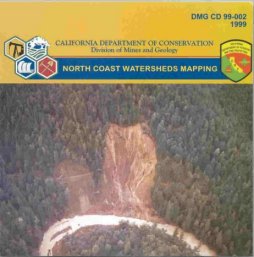
 During the early 1980s, under the provisions of Section 208 of the Federal Water Pollution Control Act, the Environmental Protection Agency (EPA) funded a number of water protection projects that involved the geologic mapping of sensitive watersheds along California's north coast. Since then, the California Department of Conservation, California Geological Survey (CGS) has been contracted by the California Department of Forestry and Fire Protection (CDF) to produce maps for parts of Mendocino, Humboldt, and Del Norte counties, and other selected watersheds throughout the state (see
Watersheds Index Map).
Maps (PDF)
Request all NCWMP PDFs and GIS data as one download (284 megabyte Zip file). Or, use the links below to request individual maps.
Metadata for NCWMP Geology maps
Metadata for NCWMP Geomorphic Features maps
GIS Data
ESRI export (.e00) files | Download consists of one zip file containing eight export files. Each thematic layer (or coverage) spans the entire study area of 60 quadrangles. Scale 1:24,000
|
DOWNLOAD GIS DATA (22 MB zip file)
|
