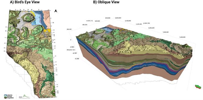
 Figure 1. A regional-scale subsurface geologic model from A) bird’s-eye view and B) oblique view showing surficial and internal distribution of geologic formations; click/tap image to open a high-resolution version. Source: Reprinted from 3D Provincial Geological Framework Model of Alberta, Version 2 Metadata and Methodology, Alberta Energy Regulator / Alberta Geological Survey, AER/AGS MOD 2018-02.
Purpose
Subsurface geologic framework maps are a fundamental data source for modeling changes over time, managing risk to life-safety, public and private infrastructure, and economic welfare (Figure 1). In 2021, the California governor and legislature approved funding for the California Geological Survey to develop a multibenefit subsurface geologic framework mapping pilot project to support the state in sustainable groundwater management, seismic hazard mitigation, carbon sequestration, and mineral resource evaluations. Through collaboration with state partners and stakeholder groups, the CGS developed a scope of work for a pilot project in the southern San Joaquin Valley based on the needs of project stakeholders and data availability, density, and quality required for subsurface geological mapping and modeling.
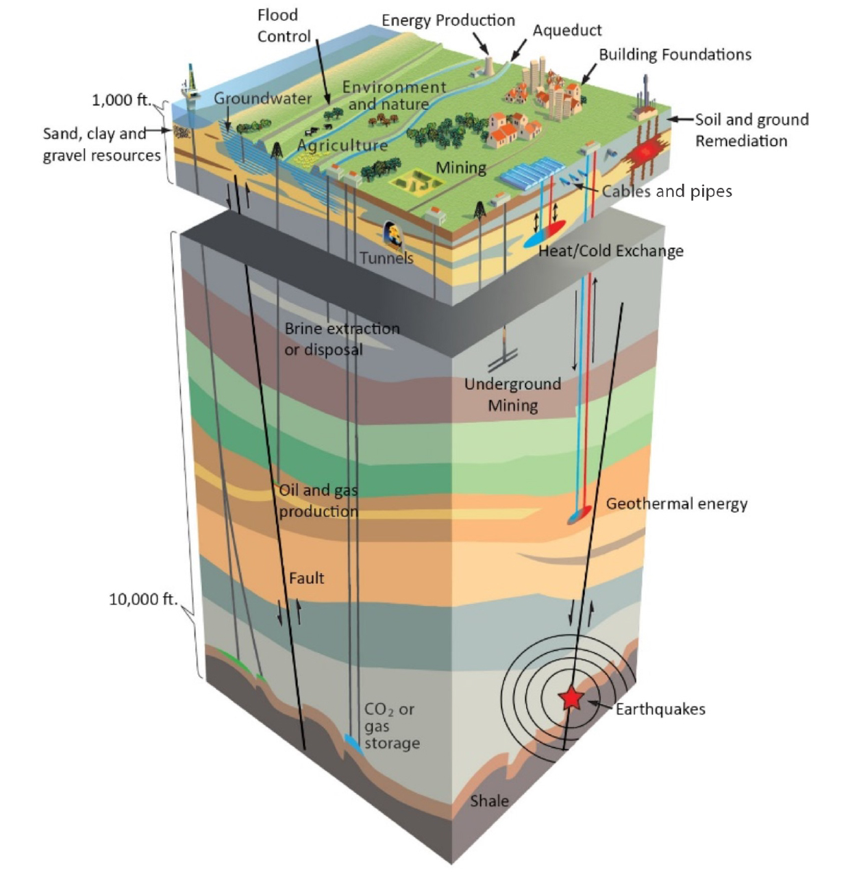 Figure 2. Example subsurface geologic diagram with various co-located, multibeneficial uses and interests displayed. Represented features include CO2 or other gas storage, geothermal energy, oil and gas production, brine extraction or disposal, mining, flood control, energy production, agriculture, natural environment, built environment, and more.
Source: Modified from TNO, Geological Survey of the Netherlands.
Figure 2. Example subsurface geologic diagram with various co-located, multibeneficial uses and interests displayed. Represented features include CO2 or other gas storage, geothermal energy, oil and gas production, brine extraction or disposal, mining, flood control, energy production, agriculture, natural environment, built environment, and more.
Source: Modified from TNO, Geological Survey of the Netherlands.
Web page by:
California Geological Survey - Regional Geologic and Landslide Mapping Program
Last modified: 9/23/2025
